Same planet. A different sense of scale.
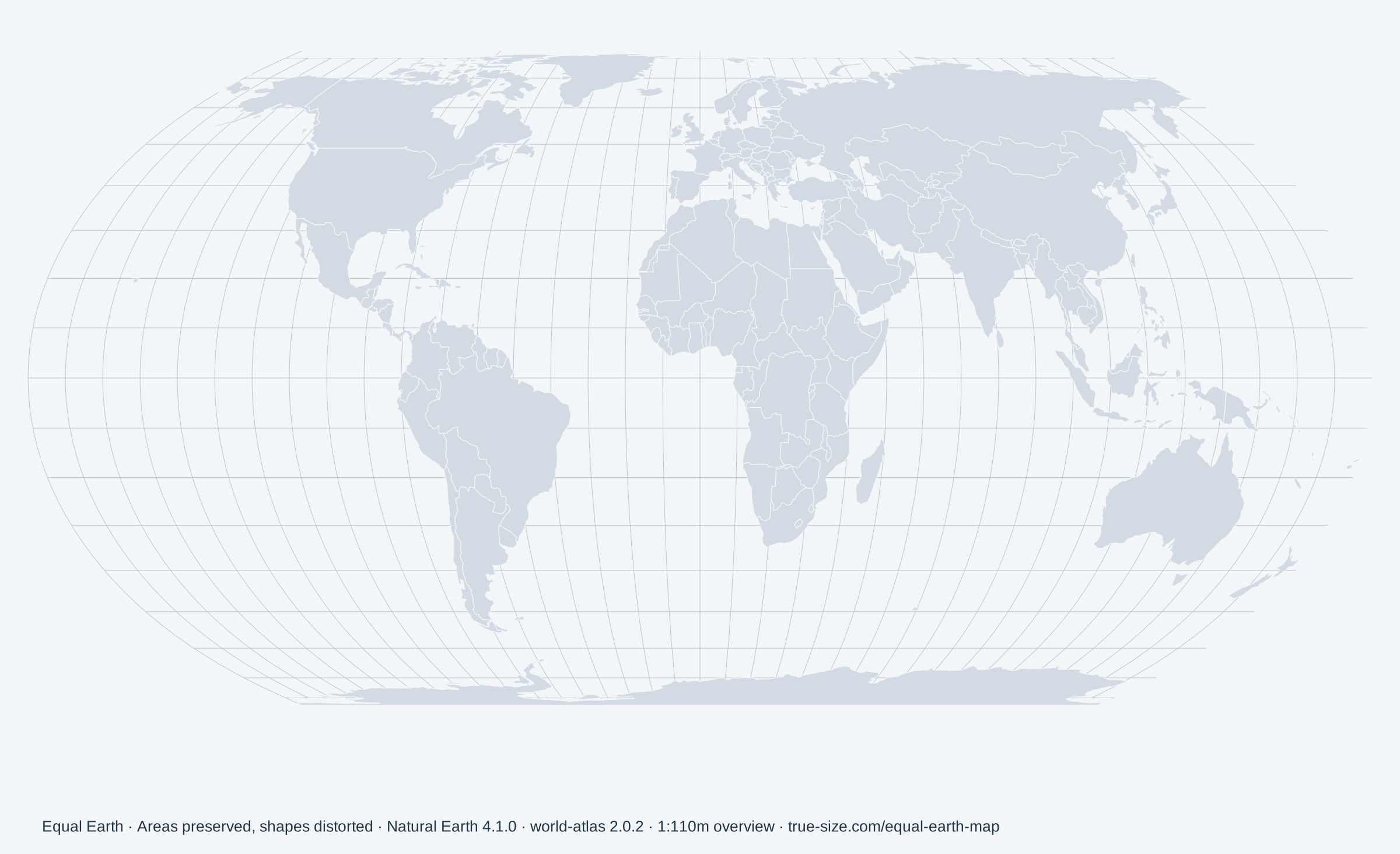
A familiar world map can make Greenland seem close to Africa in size. The reason is projection: on a Mercator map, areas farther from the equator appear increasingly large. Equal Earth keeps relative areas in proportion across the whole map.
Choose a country or try one of the comparisons above. Equal Earth is useful when your question is “how much space does this place occupy?” Mercator preserves local angles, but it is a poor guide to relative country areas at the world scale.
Neither view preserves everything. Equal Earth changes shapes and distances; Mercator enlarges high latitudes and cannot show the poles at a finite distance. The two views are fitted to the available space, so compare places within each view rather than measuring pixels across views.
To move country outlines and compare particular places, use the country size comparison tool, or explore Greenland and Africa, Russia and Africa, and Brazil and Australia.
Why is Equal Earth in the news?
The African Union backed the Correct the Map campaign in 2025. On September 4, 2026, it welcomed a UN General Assembly resolution encouraging maps that better represent the relative areas of Africa and other regions. This renewed attention to how world maps influence our sense of scale.
Equal Earth itself was designed in 2018 by Bojan Šavrič, Tom Patterson and Bernhard Jenny. It is one of several equal-area projections. The campaign does not make it a distortion-free map or the best projection for every use.
Background checked September 12, 2026. African Union statement · Equal Earth projection reference
A few things worth knowing
Is this the most accurate world map?
It is accurate for relative area within the boundary model used here. There is no flat world map that preserves every area, shape, angle and distance at once. Choose a projection for the question you want to answer.
Why does Antarctica look stretched?
Equal Earth represents the poles as lines. Antarctica keeps its relative area, but its shape changes. A dedicated polar map is more useful for studying its shape. The Mercator view here clips the world at about 85° north and south.
Can I download this map for a lesson or presentation?
Yes. The PNG export contains the complete Equal Earth map, your highlighted places, the projection name and its data source. It is 2400 pixels wide. It is an overview map, not a detailed atlas or a navigation chart.
Why are some small places hard to see?
The map uses generalized world boundaries. Try search or zoom for small countries and islands. Some very small features are simplified or absent at this resolution. Country and region names follow the source dataset.
Map data and area calculations
Both projections use the same Natural Earth boundary snapshot, distributed by world-atlas. The example ratios are calculated from those geometries on a sphere with a radius of 6,371 km. They are approximate model comparisons, not official land-area statistics.
Africa combines the African country geometries, Western Sahara, Somaliland and Saint Helena in this dataset. Overseas parts of France, Portugal and Spain are not separated from their source country shapes. Greenland is a separate region. Shared country identifiers, such as Australia and its separately drawn islands, are grouped together.
Boundaries and names are a geographic reference, not a statement about sovereignty. This is a fixed, generalized snapshot and may differ from current official boundaries. Existing country comparison pages may use a different stated statistical area basis; see our site methodology.
Natural Earth 4.1.0 · world-atlas 2.0.2 · 1:50m. Dataset documentation · Natural Earth data terms · Choosing world map projections